Map key symbols help you understand what a map shows without reading long descriptions beside every feature. They represent roads, rivers, schools, hospitals, forests, mountains, railway lines, boundaries, and many other places or geographic features. A map key, also called a map legend, explains what these symbols mean.
Whether you are a student learning geography, a traveler planning a route, or a hiker exploring an unfamiliar area, understanding map key symbols makes maps easier to read. You can identify important locations, understand the surrounding landscape, and interpret information more confidently.
In this guide, you will learn the meanings of common map symbols, understand how colors and line patterns work, explore topographic map features, and discover how to read a map legend step by step. You will also find practical examples that show how different symbols work together on a map.
What Are Map Key Symbols?
Map key symbols are visual signs used to represent real-world features on a map. They can appear as small pictures, geometric shapes, colored areas, letters, or different types of lines.
For example, a blue line may represent a river, a tree icon may identify a park, and an airplane symbol may mark an airport. The map key explains the meaning of these symbols so readers can understand the information presented.
Symbols are useful because maps have limited space. Instead of writing the name and description of every feature, mapmakers use compact visual elements to communicate information quickly.
Map key symbols are commonly found on road maps, tourist maps, topographic maps, hiking maps, weather maps, school maps, and digital navigation applications.
What Is the Difference Between a Map Key and a Map Legend?
A map key and a map legend generally refer to the same thing. Both explain the symbols, colors, patterns, and lines used on a map.
A map key might show a blue line beside the word “River,” a patterned line beside “Railway,” and a building icon beside “School.” Readers can then match those examples to the features displayed on the main map.
The most important rule is to consult the legend belonging to the map you are using. Symbols can have different meanings depending on the map’s purpose and the organization that created it.
Common Map Key Symbols and Their Meanings
The following table provides a quick reference to familiar map symbols. These descriptions represent common conventions, not universal rules. Always check the map’s own legend to confirm the exact meaning.
| Symbol or appearance | Common meaning | Where you may see it |
| Blue wavy line | River or stream | Physical and topographic maps |
| Blue shaded area | Lake or other water body | General and topographic maps |
| Green shaded area | Forest, vegetation, or park | Physical and outdoor maps |
| Brown contour lines | Elevation and land shape | Topographic maps |
| Thick colored line | Major road or highway | Road maps |
| Thin solid line | Smaller road or path | Road and hiking maps |
| Dashed line | Designated route, trail, or boundary | Various map types |
| Dotted line | A feature defined by the legend | Specialized and general maps |
| Small circle or dot | Settlement or marked location | Regional and city maps |
| Star | Important location, sometimes a capital | Political and historical maps |
| Airplane icon | Airport or airfield | Travel and road maps |
| Medical cross or H | Healthcare facility | City and service maps |
| Tree icon | Park, woodland, or recreational area | Tourist and outdoor maps |
| Railway-track pattern | Railway line | Transportation maps |
| Building outline | Building or structure | City and topographic maps |
| Arrow or compass rose | Direction, often north | Navigation maps |
Road and Transportation Symbols
Transportation symbols help readers understand road networks and identify travel-related facilities.
A prominent line may indicate a major road, while thinner lines may represent smaller streets. Railway lines often use a distinctive pattern, and airports may be identified with an airplane icon. Parking areas and fuel stations can also have recognizable symbols.
These conventions are useful when planning a journey or studying the transportation network of a town or region.
However, road colors and line widths differ between map publishers. A thick red line on one map might represent a major highway, while another map may use a different color. Always match the symbol with its legend.
Water and Natural Feature Symbols
Natural features help readers understand the physical landscape. Common examples include rivers, lakes, forests, coastlines, mountains, wetlands, and streams.
Blue commonly represents water, while green often indicates vegetation. Brown contour lines may show the shape and elevation of the land.
Some topographic maps also distinguish between different types of streams. For example, a map may use different line styles for perennial and intermittent watercourses. The legend explains which style represents each feature.
Recognizing these symbols can help hikers identify waterways, travelers understand the landscape, and students learn how natural features are distributed.
Building and Public Service Symbols
Many maps use small icons to identify important buildings and services.
| Symbol or label | Common meaning |
| H or medical cross | Hospital or healthcare facility |
| School icon | School or educational building |
| Police badge | Police station |
| Flame or fire engine | Fire station |
| P | Parking area |
| Fuel pump | Gas station |
| Bed icon | Hotel or lodging |
| Storefront | Shop or commercial building |
| Place of worship icon | Religious building |
| Monument icon | Historic site or landmark |
These symbols are especially useful on city maps, tourist maps, and public-service maps. Some symbols are familiar across many mapping systems, but their exact meaning should still be confirmed through the relevant legend.
What Do Map Colors Mean?
Colors make it easier to distinguish geographic features. They can separate water from land, highlight transportation routes, and show different types of terrain.
Although certain color conventions are common, no single color system applies to every map.
Blue: Water Features
Blue commonly represents rivers, streams, lakes, seas, and oceans. On many topographic maps, blue lines show waterways and blue areas represent larger bodies of water.
The line style may provide additional information about a water feature. For instance, some maps distinguish between streams that flow throughout the year and those that flow only during certain periods.
Green: Vegetation and Forests
Green often represents vegetation, wooded areas, forests, or parks. On outdoor maps, green shading can help readers identify areas with tree cover or other vegetation.
The precise meaning depends on the map type. A general tourist map may use green to identify parks, while a specialized map may use several shades to represent different land-cover categories.
Brown: Elevation and Terrain
Brown is commonly used for contour lines on topographic maps. These lines connect points of equal elevation and help readers understand the shape of the land.
Closely spaced contour lines usually indicate a steep slope, while widely spaced lines generally indicate a gentler slope.
Brown may also appear in other terrain-related markings, depending on the mapping system.
Red and Orange: Roads and Routes
Red and orange may highlight highways, major roads, selected routes, or other important features.
On digital maps, these colors may also be used to indicate traffic conditions or distinguish a suggested route from surrounding roads. Their meaning depends on the application and its legend.
Black, Gray, Yellow, and Other Colors
Black is frequently used for text, buildings, boundaries, and human-made features. Gray may indicate developed areas or paved surfaces, while yellow can represent certain types of land cover or road classifications.
These meanings are not universal. If a color is important to interpreting the map, check the legend rather than relying on assumptions.
Types of Map Symbols
Map symbols can be grouped into three basic categories: point symbols, line symbols, and area symbols. Understanding these categories helps explain how maps represent different types of geographic information.
Point Symbols
Point symbols identify individual locations. Examples include schools, hospitals, monuments, railway stations, and mountain summits.
A point symbol may be larger than the real-world feature it represents because it needs to remain visible at the map’s scale. It identifies a location rather than showing the feature’s actual size.
Line Symbols
Line symbols represent features that extend across a distance. Roads, rivers, railways, trails, pipelines, and boundaries are common examples.
Their colors, widths, and patterns help distinguish one feature from another. A solid line, for example, may represent one type of route, while a dashed line represents another.
The exact interpretation depends on the map legend.
Area Symbols
Area symbols represent features that cover a region rather than a single point or narrow route.
Examples include lakes, forests, parks, wetlands, deserts, and built-up areas. Mapmakers often use colored shading, outlines, or repeated patterns to show these features.
Together, point, line, and area symbols allow maps to communicate large amounts of information in a compact space.
How to Read a Map Key Step by Step
Reading a map legend becomes easier when you follow a consistent process.
Step 1: Find the Map Key
Look for a section labeled “Key,” “Legend,” or “Map Symbols.” It may appear in a corner of a printed map or in a separate information panel on a digital map.
Step 2: Identify the Symbol
Look carefully at the symbol’s shape, color, and line pattern. A blue line and a blue shaded area, for example, may represent different water features.
Step 3: Match the Symbol With Its Meaning
Find the same symbol in the legend and read its label. Do not assume that a familiar icon has the same meaning on every map.
Step 4: Locate the Feature
Find the symbol on the main map. Use nearby roads, landmarks, place names, and natural features to understand its position.
Step 5: Check Direction and Scale
Use the north arrow or compass rose to understand direction. Check the map scale when estimating distances between places.
Step 6: Confirm Important Details
For travel, hiking, or other practical activities, check the map’s date and reliability. Roads, facilities, trails, and other features may change over time.
A Simple Example of Reading a Map Key
Imagine a neighborhood map that shows a school, a park, a river, and a main road.
The legend identifies a building icon as a school, green shading as a park, a blue line as a river, and a thick line as a main road.
By matching these symbols, you can locate each feature and understand how the places relate to one another. If the school lies north of the park, the map’s directional information helps you interpret their relative positions.
This example demonstrates why the map key matters: the symbols become useful when you can connect them to the features displayed on the map.
Map Key Symbols on Different Types of Maps
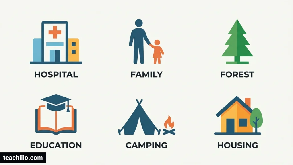
Different maps serve different purposes, so their symbols and legends vary.
Road Maps
Road maps emphasize highways, local streets, junctions, bridges, toll roads, and transportation services. Their legends may also identify parking areas, fuel stations, and road classifications.
Topographic Maps
Topographic maps show natural and human-made features while providing information about elevation. Their symbols may represent contour lines, streams, buildings, roads, vegetation, trails, and boundaries.
They are particularly useful for understanding terrain and planning outdoor activities.
Hiking and Trail Maps
Hiking maps focus on walking routes, trail difficulty where provided, campsites, viewpoints, water sources, and other outdoor features.
Reading these symbols can help hikers plan a route and recognize potential obstacles. However, a map should be combined with current local information when safety is important.
Tourist Maps
Tourist maps highlight attractions, museums, historic sites, hotels, restaurants, public transportation, and visitor services.
They often use recognizable icons to help visitors locate destinations quickly.
Weather Maps
Weather maps use specialized symbols to show conditions such as rain, snow, cloud cover, wind direction, and thunderstorms. Their legends differ from those used on ordinary road maps.
Digital Maps
Digital mapping applications display symbols for destinations, transportation, selected routes, traffic, and public services. Some allow users to turn different information layers on or off.
Because icons and colors can differ between applications, consult the application’s map legend or help information when a symbol is unclear.
How to Understand Contour Lines and Map Scale
Contour lines and map scale provide important information beyond the identification of individual locations.
What Do Contour Lines Mean?
Contour lines connect points at the same elevation. Their spacing helps readers understand how steep or gentle the terrain is.
When contour lines are close together, the ground is generally steep. When they are farther apart, the slope is usually gentler. Closed contour lines may indicate a hill or depression, depending on the markings and context.
Contour intervals, which show the elevation difference between successive contour lines, are important when interpreting the terrain. The interval should be stated in the map information or legend.
How Does Map Scale Work?
Map scale describes the relationship between distance on a map and distance on the ground.
For example, if a map uses a scale of 1:50,000, one unit of measurement on the map represents 50,000 of the same units on the ground. Therefore, 1 centimeter on the map represents 500 meters on the ground.
This calculation helps estimate straight-line distances between locations. Actual travel distances may be longer because roads and trails do not always follow straight lines.
Common Mistakes to Avoid When Reading Map Symbols
Even familiar symbols can be misunderstood. Avoid these common mistakes to interpret maps more accurately.
Assuming All Maps Use the Same Symbols
A dashed line may represent a trail on one map and a boundary on another. Always consult the legend belonging to your map.
Treating Colors as Universal Rules
Blue often represents water and green often represents vegetation, but specialized maps may use different color systems.
Ignoring Line Patterns
Solid, dashed, and dotted lines may represent different features. Examine the pattern as well as the color and thickness.
Confusing Symbol Size With Real Size
A symbol is often enlarged to remain visible. A building icon does not necessarily represent the building’s actual dimensions.
Forgetting the Scale
Two locations that appear close together on a map may be far apart in reality. Use the scale to estimate distance and allow for the actual route when planning a journey.
Using Outdated Maps
Roads, trails, and services can change. Check for updated information when navigation or safety depends on the accuracy of the map.
Frequently Asked Questions
What are map key symbols?
Map key symbols are visual signs used to represent real-world features, such as roads, rivers, buildings, schools, and mountains. Their meanings are explained in the map’s key or legend.
What are the most common map key symbols?
Common examples include lines for roads and rivers, shaded areas for water or vegetation, icons for public services, railway patterns, and contour lines for elevation. Exact meanings depend on the map.
What is the difference between a map key and a map legend?
The terms generally mean the same thing. Both describe the section that explains the symbols, colors, lines, and patterns used on a map.
What does blue mean on a map?
Blue commonly represents water features such as rivers, lakes, streams, and oceans. Some digital or specialized maps use blue for other purposes, so check the legend.
What do dashed lines mean on a map?
Dashed lines can represent trails, boundaries, roads, or other designated features. Their meaning depends on the map’s legend and the specific line pattern.
What are contour lines used for?
Contour lines connect points of equal elevation. They help readers understand the shape of the land, identify hills and valleys, and estimate how steep a slope may be.
Why do maps use symbols instead of words?
Symbols save space, reduce visual clutter, and help readers identify features quickly. They also allow maps to display many different types of geographic information in a compact format.
Are map symbols the same in every country?
No. Some conventions are widely shared, but symbols may differ between countries, map publishers, and mapping systems. The legend provides the most reliable explanation for a particular map.
How can students learn map key symbols?
Students can begin with familiar features such as roads, rivers, parks, and schools. They can match symbols with their meanings, practice with simple maps, and create their own map legend.
Conclusion
Map key symbols make maps easier to understand by representing real-world features through pictures, shapes, colors, and lines. They help readers identify roads, rivers, forests, buildings, public services, boundaries, and geographic features.
Learning to read a map key is an important step toward understanding how maps communicate information. By checking the legend, interpreting colors carefully, recognizing different line patterns, and using the map scale, you can read maps with greater confidence.
Whether you are studying geography, planning a trip, or exploring an unfamiliar area, understanding map key symbols helps you interpret locations and landscapes more accurately.

I’m Arthur Ellison, a British writer with a fascination for numbers, quantities, and the questions people ask about how many. I enjoy researching facts, comparisons, measurements, and everyday statistics, presenting them in straightforward language. My goal is to make numerical information easy to understand, useful, and interesting for curious readers everywhere.
Books:
The Curious World of How Many
Numbers, Quantities and Everyday Facts